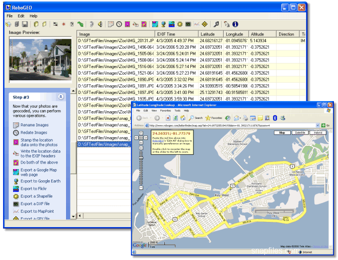
RoboGEO is a tool to geo-reference digital images with latitude, longitude, and altitude information. It can print this information onto the actual image (small footer on image) and also add it to the EXIF headers, allowing you to permanently link the photo to the GPS coordinates. RoboGEO... [Read more...]