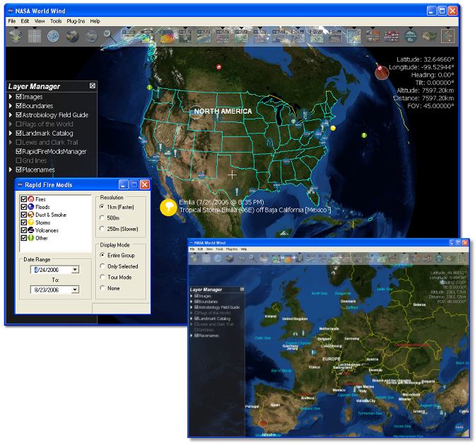
World Wind is an open source project, that lets you zoom from satellite altitude into any place on Earth. It uses Landsat satellite imagery and Shuttle Radar Topography Mission data, as well as several data sources that provide historical and information on storms, fires, floods and other major... [Read more...]